Polar Coordinates

Definition

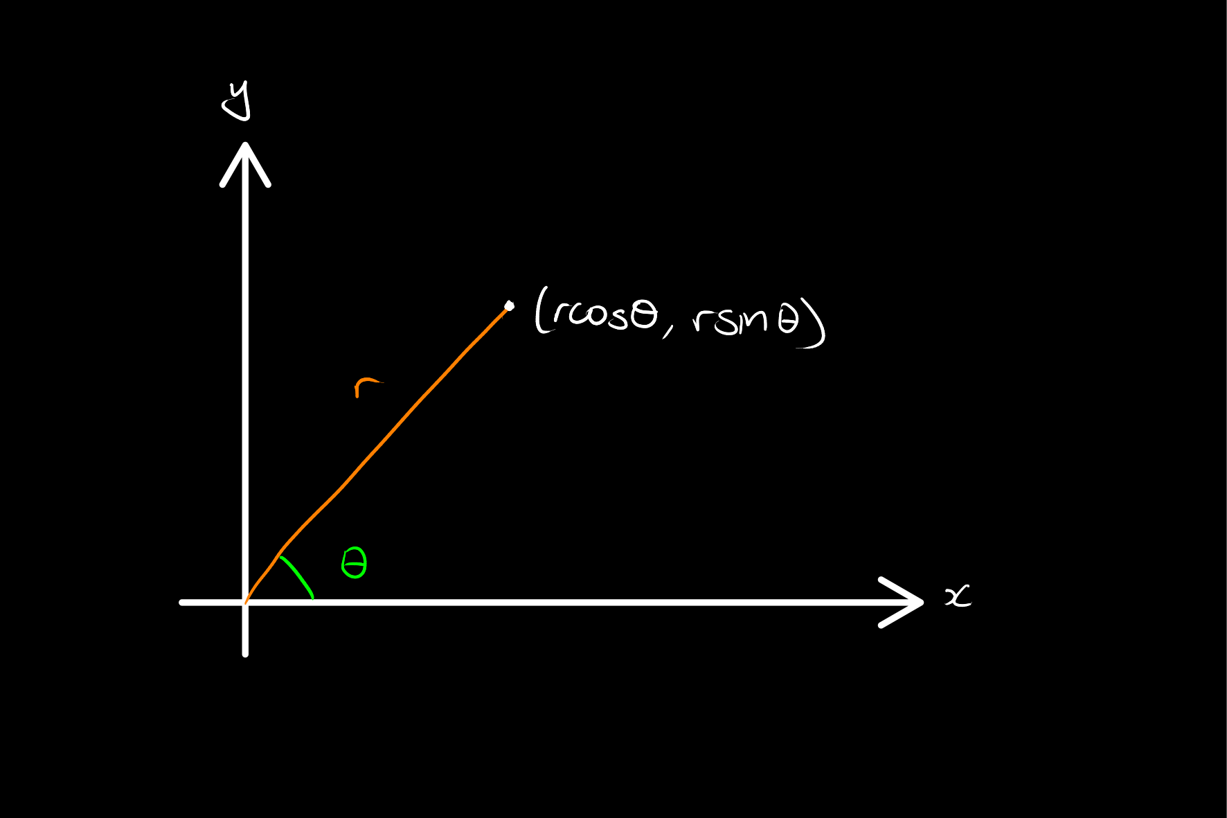
Polar coordinates are a coordinate system for R2 in which a point is defined by its distance from the origin and the angle to a reference direction. In particular, we represent coordinates as the image under the map

F(r,θ)=(rcos(θ),rsin(θ)).
Theorem

Given coordinates of the form (x,y)=(rcos(θ),rsin(θ)), r is uniquely defined up to sign, and if r0, then θ is uniquely defined up to an integer multiple of 2π.

Proof

Suppose that x=rcos(θ) and y=rsin(θ). It is clear that

(xr)2+(yr)2=x2+y2r2=1r2=x2+y2r{±x2+y2}.

Now, suppose that there are two angles θ and φ such that x=rcos(θ)=rcos(φ) and y=rsin(θ)=rsin(φ). Then, we have that

cos(θφ)=cos(θ)cos(φ)+sin(θ)sin(φ)=x2r2+y2r2=x2+y2r2=1.

Hence θφ=2πn.


From the above, it is typical to restrict to r0 and θ[0,2π), and enforce if r=0 then θ=0, as to construct uniquely defined coordinates.